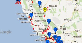
Predicting where earthquakes will strike next and when is nearly impossible, but researchers are making headway in their efforts to at least figure out which areas are the most likely to be hit. A team of experts at the University of California in Davis (UCD) developed the most accurate such model.
This was established following a competition between 7 earthquake prediction models, all of them commonly used by authorities. The UCD team, which was funded by NASA and included Jet Propulsion Laboratory (JPL) expert Andrea Donnellan proved to be the most efficient of the lot.
At this point, the best models are only about 10 times more efficient than a random prediction, which is not really that much considering all the factors involved in triggering an earthquake. The efficiency of models is reduced by the inability to plant sensors deep underneath fault lines.
These are areas where tectonic plates slam against each other. One of them is always driven underground, but the sliding process can go wrong. If the two plates become jammed, energy accumulates at the boundary until a threshold is exceeded. At that time, they snap and produce tremors.
In the new investigation, scientists looked at 7 models whose purpose is to consider such factors when making predictions of where a tremor will strike next. For this study, the participating teams were asked to forecast the probability of a magnitude 5 tremor or larger hitting California.
The research covered a time frame stretching from January 1, 2006 to December 31, 201. “The region included in the competition was divided into approximately 8,000 grid squares,” a JPL statement says.
“While all the forecasts showed some success in forecasting the locations of likely earthquakes, the NASA-funded UCD forecast team was found to be the most accurate at picking the quake locations,” the official press release goes on to say.
The model was capable of predicting 17 of the 22 affected grids, and determine 8 of them to be subjected to an increased risk of suffering from the effects of an earthquake. These results were significantly better than those provided by other models.
“These forecasts are helping guide our data collection efforts by focusing our attention on regions with higher earthquake probability,” JPL research scientist Andrea Donnellan explains.
“This approach worked well for capturing the motions of the 2010 magnitude 7.2 El Mayor-Cucupah earthquake in Mexico's Baja California using NASA's Uninhabited Aerial Vehicle Synthetic Aperture Radar,” the expert concludes.

 14 DAY TRIAL //