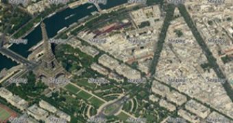
Render static Bird’s Eye images from Virtual Earth has never been easier than with an application offered by Chris Pendleton, Virtual Earth tech evangelist, Microsoft. Pendleton has simplified the process of grabbing and stitching tiles with Virtual Earth Bird's Eye imagery into static images. The app provides a way for VE Bird's Eye tiles to come together in a single image. In order to do so, developers have to turn to the Virtual Earth Web Services, as MapStyle enumeration will not help them at all in this regard.
“It recently occurred to me that there is a misunderstanding within the Virtual Earth Web Service SDK that may lead you to believe that you could set the MapStyle enumeration to get a Bird’s eye image. Not the case,” Pendleton sated. “This is part of the method for getting tiles (not an actual map). So, via the Virtual Earth Web Service you have access to all of our tiles – road, aerial, hybrid and Bird’s eye, and in desktop and mobile flavors – and can make your own mapping experiences with them.”
In order to make it easy for non-coders to also access static Virtual Earth Bird's Eye images, Pendleton has made available the application on his Windows Azure Cloudapp site. At the same time, coders will need to know that Pendleton is offering the actual code on his blog. Of course, this implies additional effort on the part of the developers.
“The application will allow a user to enter an address, geocode the address, take the coordinates and request the Bird’s eye map tiles via VEWS, then stream a new image out of the tiles for rendering to the client. You will need to add references to the Token Service, Imagery Service and Geocode Service for this application. You will also need to enter your username and password for your developer or customer account in order to access the Virtual Earth Web Services,” Pendleton added.

 14 DAY TRIAL //