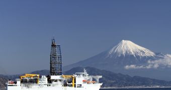
A team of scientists recently took to the seas in eastern Japan to try and find out why the Tohoku Earthquake occurred two years ago. Their investigation finally revealed how such a massive natural disaster could have occurred in an area that was previously deemed to be of little concern.
The magnitude 9.0 tremor occurred on Friday, March 11, 2011, around 70 kilometers (43 miles) east of the Oshika Peninsula of Tōhoku. The epicenter was very shallow, at just 30 kilometers (19 miles). The fault line that caused this undersea megathrust earthquake did not exhibit any warning signs.
The World Bank estimates that this event was the costliest natural disaster in history, with an attached price tag of $235 billion (172 billion euros). Nearly 15,900 people lost their lives in the earthquake and ensuing tsunamis, while 6,150 others were injured, and 2,651 disappeared. Around 130,000 buildings were destroyed entirely, while 254,000 others collapsed partially.
The Tohoku Earthquake was the strongest ever recorded in Japan, and the fifth most intense to take place since modern-day record-keeping began, in 1900. The mission aimed at understanding why it occurred is called the Japan Trench Fast Drilling Project.
Details of the research appear in three papers published in the latest issue of the top journal Science. The group enrolled the world's deepest-drilling oceanographic ship, the Japanese research ship Chikyu, in their efforts to drill through the troublesome fault line, Nature reports.
Researchers determined that the fault line was unusually thin and weak. When the 2011 disaster occurred, two earthquakes were produced simultaneously. The first originated deep under ground and caused the ground to shake in a conventional manner. The other was very intense and very shallow.
The latter is responsible for the massive landslip that occurred during the tremor, which moved the main island of Japan, Honshu, about 2.4 meters (8 feet) east. Even Earth's axis was shifted by 10 to 25 centimeters (4 to 10 inches). The European Space Agency's GOCE satellite (now decommissioned) picked up the earthquake's sound waves from low Earth orbit.
During the study, the research ship drilled through 1 kilometer (0.6 miles) of ocean crust, at a depth of more than 7 kilometers (4.5 miles) under the Pacific Ocean. They extracted a sample of clay from between the two tectonic plates that are interacting at that location. Analysis of the clay revealed a severe problem.
The clay layer between two tectonic plates is usually tens of meters thick, sometime even over 100 meters (333 feet) thick. At the eastern Japan fault line, the clay layer is only 5 meters (17 feet) thick.
University of California in Santa Cruz (UCSC) investigator Emily Brodsky, who was an author on all three Science papers, says that the slippery clay becomes even more so when it is placed under stress. Water within gets pressurized whenever the tectonic plates slid on top of each other.
As this happens, the incompressible water pushes against the upper tectonic plate, raising it by a bit, and allow subduction – the process by which one plate moves underneath the other – to occur faster.
The new results will come in handy as researchers begin drilling more boreholes in potentially-dangerous fault lines around the world. “At least, we now know what to look for,” Brodsky concludes.

 14 DAY TRIAL //