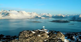
While analyzing the Greenland Ice Sheet (GIS) earlier this year, investigators at the University of Utah were able to discover a massive aquifer under the ice masses, which spans an area of around 70,000 square kilometers (27,000 square miles). The finding could help scientists better understand how the island is contributing to global ocean level increases.
Discovering that liquid water can endure in a frozen winter landscape is amazing, the team says. The massive formation, called a perennial firn aquifer, allows water to endure with layers of multiyear snow and ice called firn. Scientists say that this groundwater may be influencing how fast glaciers melt.
Studying Greenland is very important because the northern Atlantic island has the world's second-largest ground-based ice reserve after Antarctica. As opposed to floating ices – such as those found at the North Pole – land ices have the potential to contribute to sea level rise when they melt.
It is for this very reason that scientists are so obsessed with keeping tabs on how glaciers and ice sheets in Antarctica and Greenland advanced and flow into the sea over time. Details of the latest research were published in the December 22 issue of the top scientific journal Nature Geoscience.
The lead author of the paper, and the leader of the investigation, was University of Utah professor of geography Rick Forester. “Of the current sea level rise, the Greenland Ice Sheet is the largest contributor – and it is melting at record levels,” he explains, quoted by e! Science News.
“Understanding the aquifer's capacity to store water from year to year is important because it fills a major gap in the overall equation of meltwater runoff and sea levels,” the expert goes on to explain.
The UU team first started studying the GIS since 2010, when the researchers drilled a series of holes in the ice sheet, in order to install a variety of sensors within. Last year, they returned to the same area, and collected samples from these holes, which eventually revealed the interesting aquifer.
“This discovery was a surprise. Although water discharge from streams in winter had been previously reported, and snow temperature data implied small amounts of water, no one had yet reported observing water in the firn that had persisted through the winter,” Forster explains.
The scientist believes that water is able to endure between ice particles in the firn because the massive amounts of snow that fall during the Greenland winter quickly insulate the aquifer from the effects of glacial temperatures above. In other words, temperatures never drop below freezing under the ices.
In 2012, Forster says, the GIS lost no less than 250 cubic kilometers (60 cubic miles) of ice, all of which ended up in the Atlantic Ocean, and contributed to sea level rise worldwide.

 14 DAY TRIAL //