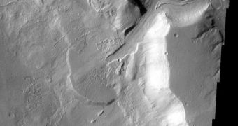
The latest studies carried out on the surface of Mars leave no doubt that large amounts of water once flowed on the surface of our neighboring planet. What researchers are pondering now is what the fossilized deltas and canals are hiding.
Evidence that the Red Planet even had an ocean in its northern hemisphere once, in addition to lakes and rivers, were corroborated by landers, orbiters and rovers deployed on the planet over the past three to four decades.
In the mean time, our scientific equipment have been improved several times over, and numerous new capabilities unlocked. These include the ability to operate orbiters around other planets. The NASA Mars Odyssey, for example, has been flying around Mars since 2001.
The NASA Mars Reconnaissance Orbiter (MRO), with its High Resolution Imaging Science Experiment (HiRISE) camera, has thus far provided invaluable sets of data on the vast number of bodies of water that existed on the planet in the past.
Unmistakable paleoshorelines have been identified at several locations all over the planet, and astrobiologists say that these are the areas most probable to have once held life. As such, future searches for primitive Martian lifeforms should be carried at these locations.
The regions bordering shorelines make up the basis for some off the most active ecosystems and habitats on any planet. As such, if life developed on the Red Planet, signs of it are bound to be noticed at these locations.
“Most of the research on Mars has focused on its early history and the recent past. Scientists had largely overlooked the Hesperian Epoch as it was thought that Mars was then a frozen wasteland,” Imperial College London expert Nicholas Warner explains.
“Excitingly, our study now shows that this middle period in Mars' history was much more dynamic than we previously thought,” adds the expert, who holds an appointment with the ICL Department of Earth Science and Engineering, Daily Galaxy reports.
The Hesperian Epoch is a time frame some 3 billion years ago, before the Red Planet underwent the massive climate change that saw all of its surface water disappearing. During its wettest sols, the planet had strings of liquid water lakes – up to 20 kilometers wide – stringed alongside the Equator.
Given the technological advancements we enjoy today, studying the Red Planet in great detail is becoming easier and easier. Already, some of the most advanced cameras on various spacecraft have sub-meter resolution, which means that a pixel covers less than a meter.
“We can now model the 3D shape of Mars' surface down to sub-metre resolution, at least as good as any commercial satellite orbiting the Earth. This allows us to test our hypotheses in a much more rigorous manner than ever before,” says professor Jan-Peter Muller.
The expert is based at the University College London (UCL) Department of Space Climate Physics Mullard Space Science Laboratory. He and his group have been conducting 3D mapping efforts of Mars for several years.

 14 DAY TRIAL //