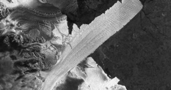
Officials with the European Space Agency (ESA) announce that they have just added 13,000 new images to MIRAVI, the satellite imaging service that follows the Envisat satellite in its orbit.
The service, opened back in 2006, can be used by anyone who wants to. What it does is it converts the raw data collected by the Envisat spacecraft as it orbits Earth into images that can be understood.
What is remarkable about this service is that it has a delay of just under 2 hours, which means that it takes 120 minutes for the data collected by the ESA satellite to be processed, and then uploaded online, for all the world to see.
Recently, ESA added 13,000 new radar images to this collection, which means that some 58,000 photographs are available to the public right now. The other 45,000 views were snapped in optical wavelengths, experts say.
“We have been very pleased with the number of people using MIRAVI to explore our planet. This enthusiasm inspired us to offer new images that provide different types of information,” explains the ESA director of Earth Observation Programs, Volker Liebig.
With the addition of the radio datasets, MIRAVI users can now observe phenomena such as flooding, sea ice, the calving of icebergs, the effects of oil spills and so on. All the new images have been collected using Envisat's Advanced Synthetic Aperture Radar (ASAR) instrument.
The visible-light images were snapped with the MEdium Resolution Imaging Spectrometer (MERIS). Now, two Envisat instruments work together to bring science directly to the general public.
“The radar is able to provide unique views of these elusive events because it is able to peer through clouds and darkness – conditions often found in the polar regions – and is particularly sensitive to the smooth water surface caused by oil spills,” ESA says in a press release.
Envisat is the largest Earth observations satellite ever constructed. Since it was launched, back in 2002, it has provided scientists and laymen with a wealth of data about our planet, and the factors that contribute to influencing its temperatures and climate.
Over the past years, a large number of other satellites have been launched to augment its function, but the fact of the matter is that this ESA spacecraft remains a landmark in Earth sciences.

 14 DAY TRIAL //