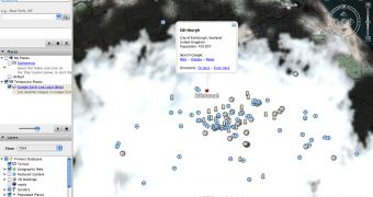
Google Earth recently received an impressive update that allows users to view live satellite images straight from the desktop of their computers. At this time, the feature is available only for Edinburgh, UK, but it seems like the company plans to expand it in the entire world. Google Sightseeing reported about this new and amazing feature, publishing a little add-on that must be installed to view live satellite images.
"As part of the Google Earth image update released last week Google quietly added a major new feature to Google Earth - live satellite images! Using the live satellite mode I created a screen capture of cars driving down a road. Live Satellite only works for the city of Edinburgh, UK but will be rolled out to other cities in the near future. Apparently Google wanted to keep this amazing new feature quiet so as to not overload the satellite's built-in web server," the blog sustained.
Because the article was published on April 1, April Fool's Day, and numerous users sustained this is only a joke, is might be only a joke as the search giant didn't announce such a revolutionary function yet. I tried the feature but, as the bloggers sustained, Edinburgh was quite cloudy so you're not able to see numerous parts of the city. However, if you want to try it for yourself, you should download the add-on from Google Sightseeing and import it into Google Earth.
The add-on is available on this link while Google Earth can be downloaded from Softpedia. Once you've started Google Earth, select the File menu and select Open. Choose the downloaded add-on and import it into Google's application. After the tool was successfully added, you should be automatically redirected to Edinburgh.

 14 DAY TRIAL //