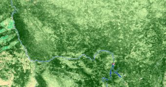
The biomass inventory that boreal forests have is one of the most elusive and important variables in the phenomenon known as the planet's carbon cycle. Knowing its value could lead to a better understanding of the factors influencing Earth's climate, and their individual importance. Such datasets would also make it a lot easier to simulate future changes that may affect the global climate, and could help researchers obtain more accurate predictive data about global warming. But obtaining this kind of readings has until now proven to be extremely difficult.
But that is all about to change now, experts at the European Space Agency (ESA) report in their official website. Investigators have been given the go-ahead to use large amounts of stacked, orbit-based images, all of them collected by the Advanced Synthetic Aperture Radar (ASAR) instrument aboard the Envisat satellite ESA operates in Earth's orbit. This ability will allow for the accurate retrieval of boreal forest biomass information, at resolutions never before possible using other methods. Analyzing these trees is extremely important, as they soak up a vast amount of the potent greenhouse gas carbon dioxide (CO2) from the atmosphere, and thus influence the planet's carbon cycle to a great extent.
“Biomass, one of the most essential climate variables defining the functions of the Earth system, is the big unknown factor in the carbon cycle. Since no biomass maps exist with a high level of accuracy, we do not know how much is changing and cannot do calculations with any certainty. With this new algorithm, it is the first time that we have something in hand that may be a first step to a global biomass map,” explains Friedrich Schiller University Jena expert, professor Christiane Schmullius. Experts know that deforestation plays an important part in the process. The trees that are cut down no longer act like storage devices, but as sources. This changes the influence of biomass in the area considerably.
“We are working with Earth System Models to try to project the future climate, and biological processes on land are of major importance for the Earth system. Biomass is the long-term result of ecophysiological processes such as photosynthesis and respiration, but it also changes quickly after disturbances or clear cutting. What is detected from ASAR data on the biomass is, therefore, vital for validating what we simulate, but could also be used for constraining parameters of the model,” adds Dr. Christian Beer, who will be in charge of handling the maps. He is based in Germany, at the Max Planck Institute for Biochemistry.
The new investigation, called the BIOMASAR project, will receive grant money from the ESA Support to Science Element (STSE). Experts already associated with the investigation say that the algorithm – to be used in biomass measurements – has been validated using data from Envisat. The ASAR instrument's main advantage is that it can conduct observations regardless of whether the target area is covered in clouds or not, or whether the area is shrouded in darkness during the night.

 14 DAY TRIAL //