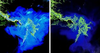
A rich selection of image from United States Geological Survey (USGS) Landsat satellite's archive of Earth imagery has been selected by an UN group for addition to the Memory of the World International Register. The images are considered worthy to preserve humanity's documentary history.
The recognition is an honor for the USGS, since images from one of its satellite will from now on be part of what is generally accepted to be the world's history. The purpose of the international Register is to safeguard the most important aspects of humanity, as well as of its tumultuous history.
The Landsat program of Earth observation has been a joint initiative between the USGS and the American space agency for the better part of 40 years. The amount of vital resources that Landsat satellites have provided over these decades is incalculable.
Information these spacecraft sent back to Mission Control was used extensively for applications in fields such as agriculture, geology, forestry, water resources, regional planning, mapping, emergency response, and global change research.
“During a span of almost 40 years, the Landsat series of Earth observation satellites has become a unique reference worldwide for advancing our scientific knowledge and our understanding of terrestrial systems,” US Department of the Interor assistant secretary for water and science Anne Castle says.
“The inclusion of the Landsat data archive in the Memory of the World Register is recognition of the incredible value of this long term data collection, not only for its contribution to scientific research but also for its rich international cultural value,” the official explains.
The UN initiative is administered by the renowned United Nations Educational, Scientific and Cultural Organization (UNESCO). Experts in a specially-assembled panel determined that images captured by the Landsat Multispectral Scanner (MSS) instrument are of irreplaceable value to humanity.
USGS officials say that the specific dataset the Registrar team selected was put together between 1972 and 1992. A total of about 600,000 image, each of which covers an area of about 100 by 100 miles (160 by 160 kilometers), are now officially included in the UN documents.
“The inclusion of this documentary heritage in the Memory of the World Register reflects its exceptional value and signifies that it should be protected for the benefit of all humanity,” UN officials said in a press release accompanying the announcement.
“The universal availability of the Landsat data at no charge is a key to its unique capabilities and global scope. Scientists, land managers, and students everywhere can work with long term, accurate, unbiased, and freely accessible data to confront the most difficult challenges involving land use, natural resources, and the environment,” Castle concludes.

 14 DAY TRIAL //