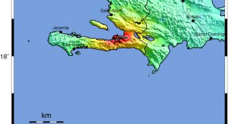
Scientists in the United States say that the January 12 earthquake that struck Haiti had its intensity amplified by local landforms and landscapes surrounding the capital Port-au-Prince.
This city was the most affected by the effects of the shallow tremor, and thousands of people lost their lives here because of poor building codes and the fact that they were living in improvised shacks.
In total, the quakes claimed the lives of more than 200,000 people, although the exact number of casualties may never be determined. Millions more were left homeless.
According to a new research paper published in the October 17 issue of the esteemed journal Nature Geoscience, it would appear that the intensity of the magnitude 7.0 tremor was amplified by local geology and landscapes around the Haitian capital.
The new study was conducted by experts at the United States Geological Survey (USGS), in cooperation with colleagues from the Haitian Bureau des Mines et de l’Energie.
This group acted immediately after the earthquake struck, by installing nine seismometers throughout Port-au-Prince, to measure variations in the amount of shaking each area of the city was subjected to.
Expert geophysicist Susan Hough, from the USGS, led the investigations effort. Her team found that the magnitude of the tremor was amplified by the fact that the Haitian capital is built inside a valley.
Additionally, it was observed that, in areas of the valley that had young and soft rocks underlying them, the effects of the quake were more widely felt.
Geologists have known for a long time that valleys and ridges can amplify the effects of earthquakes, but say that the type of rocks under the area being affected is also crucial in determining the final extent of the damages.
The conclusions of the new study were demonstrated when the experts cross-referenced their theoretical predictions against the areas of the city that suffered most damage.
They learned that portions of the city that rested on top of young rocks were most affected, and that they had the largest percentage of collapsed buildings in Port-au-Prince.
During the initial tremor, several United Nations Development Program offices and several large hotels collapsed in these areas, even if they were constructed under stricter guidelines.
“The study underscores the need to consider seismic provisions in the rebuilding effort, and suggests that topographic effects should be considered when detailed hazard zone maps are made for other regions,” USGS experts say in a press release.

 14 DAY TRIAL //