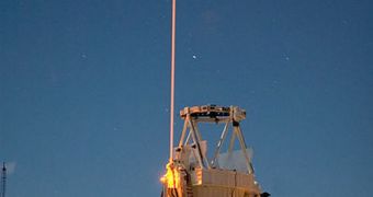
A team of experts from the UK and New Zealand says that it's possible to use LIDAR technology to determine how much coastal morphologies change following catastrophic landslides.
Knowing this is very important because it may help authorities determine when the next natural disaster will hit, thus helping them prepare accordingly. The techniques used in the new study are very accurate, and produce relevant results, the team says.
The work was conducted by experts at the University of Southampton (UK), the University of Canterbury in Christchurch and University of Auckland, both in New Zealand.
Researchers conducted the investigation near a highly active volcanic zone at the northern end of New Zealand’s North Island. A town called Matata lies nearby, in the Bay of Plenty. The reason why this is important is because it was heavily affected by a 2005 landslide.
On May 18, five years ago, devastating debris flows caused by torrential rains swept through the city, producing important damages. Steep hills exist all around the city, and the torrents produced numerous important landslides in a very short time span.
Boulders, logs and other debris were mixed with mud and a lot of water, and started flowing downhill at great speeds. Numerous cars, and even some smaller buildings, were destroyed, and became part of the landslide mass.
When things finally settled down, a large, fan-like sediment deposit was produced where the flow stopped. “Our findings are important for assessing geological hazards and reducing the dangers to human settlements,” explains professor Jon Bull.
The geophysicist holds an appointment a the University of Southampton School of Ocean and Earth Science (SOES). The organization is based at the National Oceanography Center, in Southampton.
Luckily for the team, LIDAR (Light Detection and Ranging) readings were available for the area. Some studies had taken them before 2005, and so researchers conducted another survey, covering the affected regions. The goal was to analyze the complex pattern of sediment deposition that developed.
“LIDAR uses the time taken for reflected light to return from objects or surfaces to determine the range, in a similar manner to radar,” says Southampton PhD student Helen Miller.
“It can be used to monitor coastal evolution, and to identify and precisely measure landform changes resulting from geological events such as landslides,” adds the expert.
“The use of LIDAR for debris flow hazard analysis is still in its early days, but it has the advantage of giving a synoptic view over a large area. Ours is one of the first studies using ‘before and after’ comparisons of LIDAR data to assess changes in coastal morphology,” Bull concludes.

 14 DAY TRIAL //