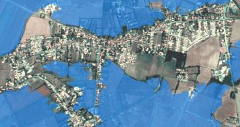
A group of insurance and reinsurance companies recently signed a new agreement with the European Space Agency (ESA), which enables the former to access Earth-observation data collected by ESA satellite to conduct a series of assessments related to the damages and extents of floods.
As extreme-weather events begin to occur increasingly often, the need to rely on orbital assets is becoming obvious to increasing numbers of companies. Floods are among the most costly phenomena ensured, as demonstrated by the 2011 Thailand flood, which set the industry back around $20 billion.
The recent agreement was signed between a consortium that includes Swiss Re, Munich Re, Allianz, Willis and Guy Carpenter, and independent, Zurich-based company PERILS, which has a lot of experience in providing satellite data to the insurance industry worldwide.
“This project is going to satisfy a longstanding industry need for detailed flood information during and after large events. While it has been possible to access satellite images in the past, this is the first time that insurers will be able to access images that have been standardized to better suit their specific requirements,” says PERILS' head of products, Eduard Held.

 14 DAY TRIAL //