14 DAY TRIAL //
 Google Maps isn't exactly Google's most controversial product. It's taken a lot of heat over Google Books, Street View and others. In some parts of the world though the mapping service is causing quite an outrage at an international level and Google is forced to maintain its impartial stance while also pleasing the different countries involved. Google has 'settled' a heated issue between India and China by showing different versions of the map of a disputed region to the users in the two countries.
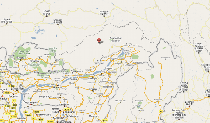
China and India are engaged in a dispute over the Arunachal Pradesh region, which both countries claim as their own but which is currently under Indian jurisdiction. Now the Chinese version of Google Maps shows parts of the region as belonging to China and inside its borders while the Indian version shows the region as part of India. What's more, the global version of Google Maps has yet another take showing the region as disputed territory with broken lines depicting the borders.
A couple of months ago Google came under harsh criticism in India after it labeled the names of several towns and areas in the province with a Chinese script. Google later claimed this was a mistake and not a deliberate decision but the harm had been done. The Arunachal Pradesh region is the eastern most state in India but the validity of the McMahon Line, which, in 1914, settled the border line between British India and Tibet, an independent country at the time, is disputed by China.
The difference between the local versions and the global one is explained by the fact that Google uses the country's official stance on borders for the localized versions of its sites. This means that Indian users will get the official map from the Indian government and the same goes for the Chinese users. It is Google policy to depict the disputed territories as such in the global version of Google Maps. The same three versions system is used for the Jammu and Kashmir region, a territory disputed by India and Pakistan.