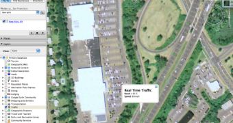
Google's downloadable mapping tool is now even more powerful than before as the Mountain View company recently implemented a new and exciting feature. The real time traffic conditions are something new for the Google application but all the users were able to test it using the web-based platform Google Maps. If you didn't use it, you should know that the real time traffic function bundled into Google Earth allows you to find out valuable information about the traffic conditions in several US cities. What's most interesting is that you can find out the average speed of the cars so you can easily choose your fastest route to reach the destination.
"Today we launched a new feature in Google Earth that provides that same real time traffic information that people have come to rely on in Google Maps. By enabling the "Traffic" layer in Google Earth, you can see a real time picture of traffic conditions to help plan a route or just check out how bad traffic might be in a city that you're exploring. It's useful information to have at your fingertips whether you're house hunting or just browsing. So come on over and check it out!" Mark Tsui, Software Engineer, proudly announced today.
If you want to test this new feature, open Google Earth and check the Traffic option included in the Layers box. If you double click it, you should be able to see all the locations that provide traffic conditions.
This is a very useful function and a new sign that Google is focused on improving the downloadable mapping solution although Google Earth was somehow abandoned in the recent period. The parent company improved it very often but, since it quietly rolled out the 4.1 beta version, Google Earth was rarely brought in the spotlights.

 14 DAY TRIAL //