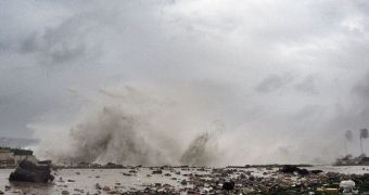
Scientists from the United States Geological Survey (USGS) say that the Mississippi River flowed backwards for around 24 hours on Tuesday, August 28, on account of the influence Hurricane Isaac exerted upon making landfall in the Gulf of Mexico.
The Category 1 hurricane produced impressive storm surges and strong winds, pushing river waters back inland at a rate of 182,000 cubic feet (5153.6 cubic meters) per second. These values were measured by the USGS stream gage in Belle Chasse, Louisiana.
According to statistics, the river was a full 3 meters (10 feet) above its average height. The gage used to provide these measurements usually indicates a flow of 125,000 cubic feet (3539.6 cubic meters) per second towards the Atlantic Ocean.
USGS scientists say that this type of inflow is usually stopped by the flow of the river itself. However, this can take a while to happen, when the river had only a medium or low flow to begin with. The elevation of the land itself can stop the body of water from flowing backwards, too.
“This reversal of flow of the mighty Mississippi is but one measure of the extreme force of Isaac. While such events are ephemeral, they are yet another reminder of why we need to respect hurricane warnings,” USGS Director Marcia McNutt explains.
Observations also revealed that numerous coastal rivers in the state of Louisiana periodically lose height, only to regain it a bit later. Scientists explain that this natural phenomenon is caused by the circular nature of the winds in tropical storms.
“As the winds sweep to the southwest, they force water out of the rivers, lowering their height. However, once the winds complete their turn to the southwest, they begin back to the northeast, allowing the storm surge to raise the river levels,” USGS researchers explain.
The agency has an extensive network of Steam gages across the country, and especially in coastal communities. These devices relay data through satellites once every 15 minutes, providing the experts with significant amounts of information on what's going on.
“This wealth of data allows USGS scientists, emergency managers and responders, and even the general public to have accurate and up-to-date knowledge of what the rivers and streams in their areas are doing. This data is particularly critical during massive flooding events like Hurricane Isaac,” the USGS group says.

 14 DAY TRIAL //