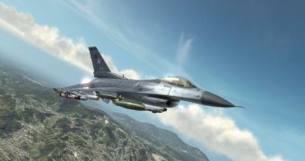
Ubisoft is really going all out in its quest to differentiate its upcoming HAWX from other flight combat games that came before it. It has not announced that it is entering a partnership with GeoEye, an imaging company that offers high resolution images of the Earth. The images that will be featured in the game will be taken by IKONOS and they will be used to make sure that the geographical areas depicted are as accurate as possible.
Ubisoft says that the team which is creating the dogfighting section of the game is now in close cooperation with GeoEye and places like Rio De Janeiro, Cape Canaveral and various sections of the Middle East are amongst the first which will be enhanced using satellite images. HAWX will have 16 international locations implemented when it ships.
GeoEye data is supplemented with data taken from the United States Geological Survey in an effort to make a topographical "underpinning" for the satellite images. The idea is that having a clear representation of the way the terrain is shaped in the in-game areas will make it easier to superimpose the satellite images and create a very accurate representation of the actual look of the places as they are seen from the air.
IKONOS made images are used in a variety of fields like U.S. national security, terrain mapping, air and marine transportation, environmental monitoring and insurance risk management.
Mark Brender, who is the corporate communications vice president at GeoEye, says that "High-resolution satellite imaging is moving from the black world of intelligence to the white world of commerce, and Tom Clancy's HAWX will bring that reality to gamers".
The enhanced graphics capabilities of today's gaming devices make it increasingly important for game developers to create as real as possible environments and HAWX promises to make it seem like you really are looking at the Middle East while dogfighting at high altitudes.

 14 DAY TRIAL //