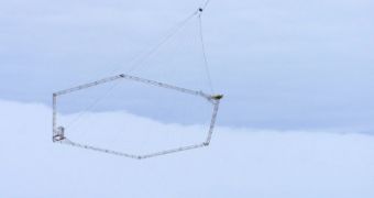
A group of scientists announce the successful testing of a new technique for mapping the unseen distribution of groundwater and ice in Antarctica. The test was carried out in the McMurdo Dry Valleys region, and went on flawlessly.
Working with funds from the US National Science Foundation (NSF), scientists at the University of California in Santa Cruz (UCSC) were able to develop a method for achieving an objective that experts have been striving for for decades.
In order to map groundwater and ice distribution, experts used an innovative, airborne electrical resistivity instrument, which was attached underneath a special helicopter. With this capability, the team expects to be able to study microbial ecosystems in sub-glacial environments.
The device is called SkyTEM, and was developed by a team of Danish investigators. It can see features buried deep under the ice, which are inaccessible to scientists through any other approach.
“For decades, geophysicists have tried to obtain images of Antarctic groundwater but have been frustrated in their efforts by thick permafrost and/or glacial ice cover,” UCSC scientist Slawek Tulacyk explains.
“In a matter of a few weeks, SkyTEM has revealed more about deep hydrological systems in the McMurdo Dry Valleys than what has been gleaned from a long series of heroic drilling and geophysical campaigns since the 1970s,” the investigator adds.
The resistivity antenna is based on a simple principle – it produced electrical currents that are focused on the group. The currents' induced magnetic field is modified by the resistivity of the materials located underneath the surface, and these changes can then be converted into maps.
SkyTEM can permeate the ground to depths of approximately 300 meters (984 feet), and can map the properties of permafrost, rock, glaciers, ices, groundwater and other similar materials. One of its advantages is that it's a non-invasive system, which is very important for preserving pristine environments, such as Antarctica.
“The ice cover in Antarctica means that researchers need to use creative technologies to study the processes operating there,” explains the director of the NSF Office of Polar Programs (OPP) Antarctic Earth Sciences, Alexandra Isern.
“It is impressive that an early career researcher successfully applied this technology and was successful in receiving funding for its implementation,” she concludes.

 14 DAY TRIAL //