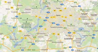
Google has updated the mapping data for the UK, Germany, Finland and Sweden. This isn't just some minor update or tweak, or else Google wouldn't make too much fuss about it. Google Maps now has a lot more info and data for those countries.
"You may notice many improvements to Google Maps in these countries, such as improved water bodies and more comprehensive local park coverage," Google announced.
Google gathered data from several organizations and agencies for the more complete maps. The company relies on any source of data it can, in the countries where there are government bodies with sufficient info those are preferred, but in many places, Google relies on local volunteers to create the maps themselves.
"For example, Germany's Federal Agency for Cartography and Geodesy (Bundesamt für Kartographie und Geodäsie) supplied us harmonized data from surveying and mapping agencies of all 16 federal states (Länder). And in the case of Finland, we acquired water body data directly from the National Land Survey," Google listed some of the sources.
The updated data is available to developers and enterprise users as well via the Google Maps API Premier or Google Earth Builder and Google Earth Pro.
But even in places where there is sufficient official data, it is not always up to date. Google Maps users who find inaccuracies can report them via the "Report a Problem" link.
The link is now visible in the lower right corner of the map in all of the countries that have been updated in this latest batch. Google then reviews the problems or suggestions and fixes the error if there is one.
In some other places though, users can simply fix the problem themselves, by making changes to the actual map, via the Google Map Maker, and then having their changes reviewed, approved and published.

 14 DAY TRIAL //