 14 DAY TRIAL //
 Google Maps and Google Earth are two products provided by the search giant that allow you to view maps and other imagery with the entire world captured directly from the satellites. Although the two solutions are quite similar, Google Maps is accessible through an online interface while Google Earth is a downloadable application that helps you view maps from your desktop. The two products are so popular that even terrorists were using them to organize attacks against several armies identified through Google's services. For example, it was reported that terrorists attacked UK troops located in Basra using Google Earth and certain images provided by the application.
At that time, the search giant decided to replace specific photographs with older ones that were captured before the departure of the army so the troops are now more secure. Both solutions displayed an impressive number of security related locations, but Google managed to hide them by replacing photos or even by making them blur to block malicious use of the images.
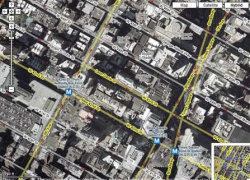
The two services provided by Google contain powerful zoom functions, allowing to you view detailed images from all around the world. Today, the company updated Google Maps again, adding subway stations to US cities as well as detailed photos with buildings from certain cities.
"Google Maps has added a whole bunch of additional data, now showing the locations of major subway stations on the regular maps. They also now feature the names of important buildings, and even the stupid nicknames given to many New York streets. While Google Maps will never be a substitute for an actual subway map (especially in New York, where the buses are as important as the subways), this is some pretty useful information. At the very least, you can use Google Maps to see what subway stops are near your location, then have an easier time finding it on the subway map," InsideGoogle reported.