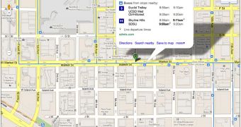
One of the great features in Google Maps, especially when you're on the go, is transit data. You can see what public transport options you have to get about in a city and also a schedule of when the buses, trains and so on, depart from a certain station.
But, as we all know, public transit isn't the most reliable form of transport in many cities, so Google is expanding the feature to support real-time arrival and departure data, enabling users to know exactly when their bus is coming.
"Google Maps for mobile and desktop can tell you when your ride is actually going to arrive with new live transit updates," Sasha Gontmakher, Software Engineer at Google, writes.
"We partnered with transit agencies to integrate live transit data in four U.S. cities and two European cities: Boston, Portland, Ore., San Diego, San Francisco, Madrid and Turin," Google.
In the cities where this data is available, the live departure times will be listed for any station, above the regularly scheduled ones. This data shows exactly how long it will be until the bus, train and so on, arrives at the station.
This comes in great in many situations, you'll know for sure if your bus is running late and how soon it's going to arrive.
The new feature works in all versions of Google Maps. Both the desktop and mobile website now support live departure times and the Google Maps for Android app has this data as well.
Considering that departure times are going to be a lot more important to you when you're on the move and away from your computer, solid mobile support is crucial.
Google is working to partner with more public transit providers, to make the feature available in more cities, but this depends on the cities themselves having a system for keeping track of the buses as well as providing real-time information to Google.

 14 DAY TRIAL //