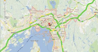
Google has announced that it's expanding its live traffic coverage in Google Maps with the addition of three new countries Norway, New Zealand and Hong Kong. Users around the world will be able to see traffic conditions in near real time in several places in these countries.
"We have expanded our live traffic coverage to Norway, New Zealand, and Hong Kong. Traffic in Google Maps was introduced in 2008, and since then our team has been working hard to bring this popular feature to more and more countries," Google announced.
"Today, you can now get traffic conditions for major cities and highways in Norway, New Zealand, and Hong Kong," it said.
Google started with the US in 2008 but added more countries later. The feature, which shows traffic conditions, i.e. light, normal or heavy traffic on the main roads and even some side streets, relies on several data sources but the biggest is Google Maps users on mobile devices.
As long as there's a data connection open, the GPS is active and users have enabled the My Location feature, Google will collect some data from your device to paint a picture of how traffic is moving.
For example, if 10 or 20 phones on a busy street show the same movement patterns it could be an indication that that's how the traffic is actually going. Google then uses that data to paint a picture, literally, of how things are moving across town and to suggest alternate routes is appropriate.
The data for the new countries is already available, all you have to do is go to Google Maps and enable the traffic layer. Of course, the data is available in the mobile clients as well, where it's even more useful, both in the regular Google Maps app as well as in the turn-by-turn navigation app Google Navigation.

 14 DAY TRIAL //