and after (right)")
 14 DAY TRIAL //
 The technical challenges of maintaining a detailed map of the world are hard enough, but things get even more complicated when you factor in political issues like border disputes. Google tries to maintain a neutral view, but, in many cases, there is no universally accepted version so the Maps team has to try to satisfy everyone.
This is tricky and Google has been criticized in the past for issues relating to borders and other sensitive issues. Google now boasts significantly more accurate border data in some regions, but is also highlighting some of the updates recently to reflect the changes on the ground.
“[T]oday we are happy to announce some significant improvements to our borders for over 60 countries and regions... Similar to satellite imagery, boundary data is available in varying levels of resolution; the higher the resolution, the better the boundaries will follow specific geographic features, such as rivers,” Charlie Hale, Geo Policy Analyst at Google, wrote.
“While we always strive to display the on-the-ground reality of a boundary's position, in practice some boundary lines are not as accurate as we would like them to be due to the available resolution of our boundary data. With these improvements, many borders will now more closely follow natural boundaries such as mountains and rivers,” he added.
New data is always added to Google Maps, be it updated satellite imagery, new Street View images or, like in this case, better border data. The update is quite significant and Google is highlighting some of the most notable and impressive changes.
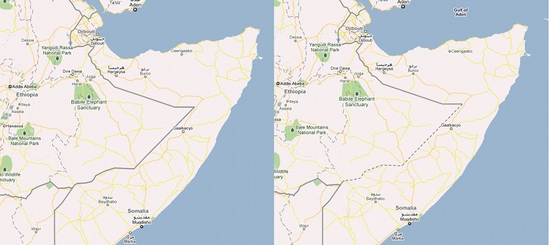
In one case, the border between Tajikistan and Kyrgyzstan is a lot more accurate. A portion of it follows a mountain ridge and with the update, the border displayed in Google Maps and Earth now follows the geography a lot closer than before. In another example, the representation of a portion of the border between Ethiopia and Somalia has been changed to reflect its disputed status.