 14 DAY TRIAL //
 Google Maps received a new improvement implemented by the Mountain View company which will now allow the consumers to view high-resolution photos with several locations in the world. This new feature provides one click access to the images captured by the users and published on Picasa Web Albums, bringing a new perspective on the imagery included in the web-based mapping tool. All you need to do is add a new mapplet to Google Maps, search for your location and then click on photo thumbnail displayed on the map.
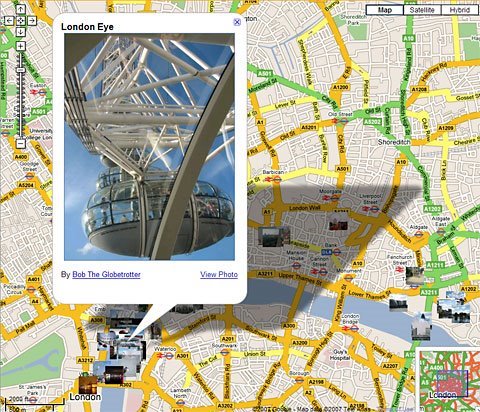
"While you browse all the photos around a given location, you can also do keyword searches drawing from the captions associated with each photo. For instance, pop over to London, zoom in to get a bird's-eye view, then type "eye" into our Mapplet's search field. Now you'll see a more finely filtered set of photos taken in and around the gigantic London Eye observation wheel by folks from all over the globe," Ping Hsin Chen, Software Engineer, Picasa, wrote in a blog post published today.
If you're a Google Earth fan, I'm sure that you know this feature because it is already implemented into the downloadable mapping tools. The only difference is that Google made a deal with Panoramio (a company which was recently acquired by the search giant) providing user-captured imagery through this service. Just like Google Maps, you can access the photos distributed by Google Earth and Panoramio using a simple click on a special icon displayed on the maps.
Picasa Web Albums is a great photo sharing service that might have a bright future if the search giant continues to improve it so often. Meanwhile, Google Earth receives new goodies periodically, becoming the top solution in its category. If you want to download Google Earth, you can take it straight from Softpedia.