Google Earth is most probably one of the best products of the Mountain View-based giant. Since its release (under the name of Google Earth) back in 2005, Google has tried to permanently improve its product. Currently, the free software application has reached its 4.3 version, which has a number of interesting new features, offering its users a better understanding of their native places. From time to time, the developers at Google Earth release updates containing new imagery.
Google Earth provides its users with an interface featuring the graphical representation of Earth, which offers information about the various locations and landmarks available worldwide. It uses satellite imagery and aerial photography in order to map the Earth's surface by superimposing layer upon layer. Users wanting to view their houses, as seen on a satellite image, need to download the Google Earth application and have an Internet connection.
One of Google Earth's most recent updates includes a set of new imagery from various parts of the world. Following Google's tradition of not disclosing the locations of the updated imagery, a number of hints have been made available. The 9 hints are supposed to make the Google Earth users search for the new imagery by themselves, using their knowledge and the Google Earth platform. By doing so, Google allows a more pleasant experience with Google Earth, enabling the users to discover new things.
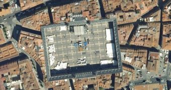
If you just can't place your finger on the specific locations, it should be easy enough to find out where the new imagery can be found, using the Google search engine. Some hints are quite intuitive, one of them referring to a place in Madrid, Spain, which can be seen in the above picture.
Last week, Google Earth received a series of updates, meant to increase the public's knowledge concerning the disaster made by Cyclone Nargis in Myanmar (Burma).

 14 DAY TRIAL //