14 DAY TRIAL //
 Although YouTube was the Google service that used to help people publish their stories and require other members' help, Google Earth tends to do the same thing using its powerful features. The downloadable application was updated with several high-resolution photos with Darfur, Sudan, showing numerous destroyed villages and damaged houses. Every location displays a link with more photos with the location able to present even more details about the area. According to the Times Online, the Sudan President, Omar al-Bashir sustained there were no atrocities but the United Nations shows some shocking statistics: 200.000 killed people in 4 years.
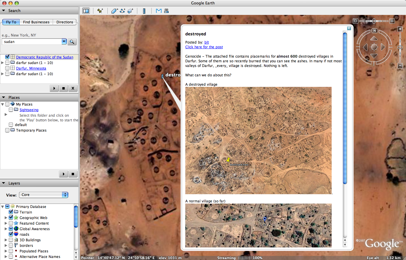
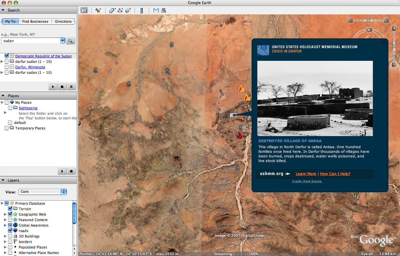
"Each icon links to a window that gives the village's name and information about the extent of its destruction. The maps include a link to a presentation by the Holocaust Memorial Museum on the crisis in the region, with photos, video, historical background and testimony. Sara Bloomfield, the museum's director, said the museum had approached Google about the project as they sought ways to highlight what they believe is genocide," the same publication reported.
As you can see in the photos attached to the article, there are numerous Sudan areas displaying damaged villages and houses. Every location shows high-resolution photos and even more pictures provided by the museum that shows the affected residents of the country.
This is not the first time when Google Earth is involved in this kind of problems. Recently, the downloadable application was accused for censoring the truth after the parent company Google removed the photos with New Orleans damaged areas. The city was attacked by hurricane Katrina, being strongly affected and damages. Just after the hurricane was over, Google removed the detailed pictured with older ones captured before Katrina assaulted the city.