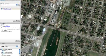
Google Earth, the company's downloadable application that allows you to view satellite maps and other imagery, was often criticized because it managed to display private images or sensitive locations from all over the world. This time, the case is somehow different because the search giant's employees tried to do a good thing by removing numerous photos but, instead of users' gratitude, they attracted only their criticism. The images concern New Orleans and the surrounded territory that was flooded by the Katrina hurricane in August, 2005.
The company removed all the pictures showing the damages caused by Katrina, including destroyed houses and ports and replaced them with older ones, captured before the hurricane assaulted the city. Although the company did a great job, it is now criticized because it censors the truth by refusing to show the results of the hurricane.
"Chikai Ohazama, a Google product manager for satellite imagery, said the maps now available are the best the company can offer. He said numerous factors "go into the databases, everything from resolution, to quality, to when the actual imagery was acquired," according to The Age.
In the past, Google Earth had several similar problems but they were all concerning the authorities. Take the example of the Basra case, when Google Earth displayed images with the UK army. The terrorists were using these images to organize attacks against the troops until Google replaced them with older ones captured before the departure of the army in the area.
This time, the case concerns the residents of the city that are also ticked off by the Google decision because the company refuses to show the truth. "Come on. Just put in big bold this: 'Google don't pull the wool over the world's eyes. Let the truth shine," said an incredulous Ruston Henry, president of the Lower 9th Ward Economic Development Association according to The Age.

 14 DAY TRIAL //