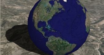
In order to meet the ever increasing needs of its users, Google Earth's functionality has been enhanced with new features, among which the Ocean in Google Earth is the most important. The innovation that version 5.0 of the popular application brings will allow users to virtually dive beneath the water surface, explore the 3D-represented underwater terrain or enjoy ocean-related articles created by experts in this area.
The latest version also comes with other features, such as Historical Imagery that will permit users to travel back in time using aerial imagery and archival satellite, Touring, which will help people create a narrated tour in Google Earth, and Google Mars 3D, which brings high-resolution imagery and terrain of the planet.
“With this latest version of Google Earth you can not only zoom into whatever part of our planet’s surface you wish to examine in closer detail, you can now dive into the world’s oceans that cover almost three-quarters of the planet and discover new wonders that had not been accessible in previous versions of this magical experience,” stated The Honorable Al Gore at the launch event in San Francisco. “Moreover, with the new historical imagery feature, you can look back in time and see for yourself the unprecedented pace of change taking place on the Earth — largely because of human influences. For example, you can watch the melting of the largest glacier in Glacier National Park—the Grinnell Glacier—image by image, for the last decade.”
Ocean in Google Earth remains the most valuable addition to the software as it combines sea floor terrain with expert content, providing users with a great chance of exploring some of the inaccessible regions of the world. For instance, those who want to virtually travel to Hawaii will have the opportunity to analyze the underwater volcanoes, enjoy videos on the marine life in the area or read about the nearby shipwrecks.
The innovative function in Google Earth is turned on by default within the application. Simply by zooming in on any ocean area, users will be able to view a dynamic water surface, and then examine the 3D sea floor after they get beneath the surface. Furthermore, the feature also comes with 20 content layers with information provided by some of the world's most well-known scientists and researchers. These layers contain data about the ocean hot spots all around the world, a geo-quiz brought by National Geographic, and videos from Jacques Cousteau's archives with rare footage of historic ocean expeditions.
“What this project helped me begin to understand,” said the Director of Google Earth and Maps, John Hanke, “is the role the ocean plays in global climate change and the impact that humans are having on the oceans and the creatures that live in it. It was a serious omission on our part not to include a better treatment of the oceans when we launched Google Earth, and I'm very happy that we've been able to address that. We now have a good substrate for publishing and exploring data about the 'other' two-thirds of the planet.”
One of the major contributors to the new stage of Google Earth has been Sylvia Earle, oceanographer and National Geographic Explorer-in-Residence. “I cannot imagine a more effective way to inspire awareness and caring for the blue heart of the planet than the new ocean in Google Earth, “ said Sylvia Earle. “For the first time, everyone from curious kids to serious researchers can see the world, the whole world, with new eyes. In a stroke, Google Earth brings life and character to the blue part of the planet, and makes obvious the many ways land, water, atmosphere and living systems connect. Many 'aha!' moments are sure to come as people discover new patterns, new correlations, and countless personal discoveries while vicariously diving into the waters of the world.”
After this announcement was made, local fourth graders took part in an interactive teaching on marine ecosystems, especially created by expert educators on the use of the Ocean in Google Earth feature. They believe that the new approach of Google Earth opens up endless possibilities for exploring and educating people on the less-understood areas of the planet.
As stated before, among the other innovations in Google Earth there is also the Historical Imagery feature. Unlike the previous versions of the software, where users could see only one set of imagery for a certain location, they will now be able to use a time slider that will show new and old satellite imagery from all over the globe, thus analyzing the evolution of a specific place over time.
Another addition is Touring, offering users the possibility to easily create and share narrated tours of Google Earth's imagery and content through simply hitting the 'record' button. Google Mars 3D comes as a virtual tour of the galaxy. Users are provided with a complete overview of Mars and high-resolution pictures and 3D terrain representation. Those fond of running, hiking and biking are now able to upload tracks from their GPS devices to Google Earth directly via the GPS Tracking feature.
Along with Google Earth 5.0, 15 more languages are available for use, besides the 26 that were already featured in the application. All 41 languages include: English (US), English (GB), French, Italian, German, Spanish (Spain), Spanish (Latin America), Dutch, Simplified Chinese, Traditional Chinese, Japanese, Korean, Portuguese (Brazil), Russian, Polish, Turkish, Thai, Arabic, Swedish, Finnish, Danish, Portuguese (Portugal), Romanian, Hungarian, Hebrew, Indonesian, Czech, Greek, Norwegian, Vietnamese, Bulgarian, Croatian, Lithuanian, Slovak, Filipino, Slovenian, Serbian, Catalan, Latvian, Ukrainian, and Hindi.

 14 DAY TRIAL //