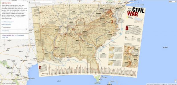
Google has launched Google Maps Gallery, a collection of interactive digital maps from various businesses, government and nonprofit organizations, including National Geographic, World Bank Group, or the US Geological Survey.
This is an extension of the Google Maps Engine public data program that the company introduced last year.
In the announcement, the Internet giant mentions that governments, nonprofits and businesses are the ones who hold onto some of the most valuable mapping data in the world. This is most often locked away instead of shared with the public and that’s why Google set up this new project.
Google sees Maps Gallery as a new way for organizations to share and publish their maps online.
Google Maps Gallery works like an interactive digital atlas that hosts a lot of maps which can also be viewed through Google Earth. Furthermore, these are all discoverable through search engines, which means they’re now more visible than ever.
Don’t expect to find simple cartographic data either. Google has put together more than basic maps of locations – it gathered up municipal construction programs, population statistics, deforestation changes, emergency evacuation routes and historic city plans.
“With the Gallery, governments, nonprofits and businesses can publish maps and manage their content on their own terms with settings that enable control over maps branding, styling and licensing. Additionally, with the ability to synchronize maps from legacy systems and open data portals to the Gallery, organizations can take advantage of having a complementary online channel for their data,” reads the announcement, highlighting yet another good use for the service.
While this is just the beginning, Google hopes to expand the project. So far, the Gallery contains content from National Geographic Society, the World Bank Group, United States Geological Survey, City of Edmonton and Florida Emergency Management.
Frank Biasi, director of digital development for National Geographic Maps, expressed his opinion on the matter, pointing out that most of these maps could only be seen in print form. But now, thanks to Google, they are available to everyone.
“Over the last 125 years, National Geographic has developed and published more than 800 maps, as one of our primary vehicles for achieving our mission to inspire people to care about the planet. But access to these maps has been limited due to their physical printed nature and their range of publication dates. Maps Gallery makes our entire collection and individual maps discoverable and viewable to the world through a simple Google Maps user experience,” Biasi said.

 14 DAY TRIAL //

