14 DAY TRIAL //
 Whenever we say "rugged handheld navigator for outdoor experiences", the first thing that comes to our mind is an all-rubber, generally yellow-colored product, with a grayscale display and not exactly very extensive features. However, that's not at all the case with Garmin's latest Oregon series of rugged navigators for outdoor enthusiasts, a family of products that come packed with all sorts of advanced features and even a full-color, touchscreen display.
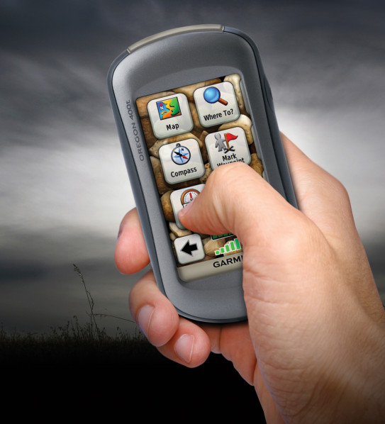
First of all, let's talk a bit in detail about each and every model from this series. Thus, according to the company's statement, the "Oregon 400t gives hikers preloaded topographic maps in 3D elevation perspective. The Oregon 400i offers anglers shoreline details, depth contours and boat ramps for inland lakes and navigable rivers. The Oregon 400c is a saltwater specialist, providing chart coverage for the coastal U.S. and Bahamas. The Oregon 300 features a worldwide basemap with shaded relief. The Oregon 200 provides a basemap that can be easily supplemented with additional mapping or charts for your adventures on land or at sea."
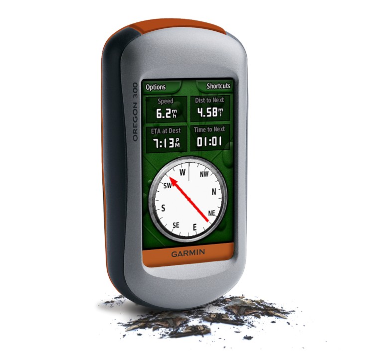
Like most of the other products from Garmin, the waterproof Oregon features a high-sensitivity GPS receiver, preloaded mapping and, most importantly, a high-resolution, color 3-inch screen that reacts as users tap or drag through menus and options. Moreover, the devices weigh only around 6.8 ounces, have an estimated functioning life of around 16 hours (provided by two AA batteries) and even come packed with a microSD card slot, for adding extra data.
Satellite reception has also been improved, due to Garmin's new HotFix feature, which automatically calculates and stores satellite information, which it can use to calculate a position without waiting for data collection from the satellites (something that could really come in handy when navigating deep canyons, for example).
However, the Oregon handheld navigators also provide some additional functions that could be really useful while in the wild. For example, there's also a barometric altimeter and electronic compass and it is compatible with Garmin's heart-rate monitors and speed/cadence sensors.
Moreover, the devices from the Oregon series are extremely versatile as far as connectivity is concerned, since the 400t, 400c, 400i and 300 allow for wireless exchange of tracks, waypoints and geocaches between other Oregon units and Colorado models. And since we're on the subject of geocaching, let's just say that this is quite easy to do with the Oregon, which quickly downloads online information for every cache, such as location, terrain, difficulty, hints and description.
Even more, the new Oregon series allows users to discover Wherigo (pronounced "where I go"), the latest GPS-based activity from Groundspeak, which is a toolset for creating and completing adventure games, historical tours or other innovative activities in the real world.
We are just a few, but there are many of you, Softpedia users, out there. That's why we thought it would be a good idea to create an email address for you to help us a little in finding gadgets we missed. Interesting links are bound to be posted with recognition going mainly to those who submit. The address is  .
.