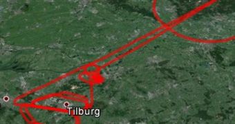
The Galileo satellite navigation and tracking constellation has recently taken a very important step forward, when its four operational spacecraft were able to track an aircraft flying over the Netherlands, from their distant geosynchronous orbit.
This is the first time Europe and the European Space Agency (ESA) were able to track an aircraft using their new, independent navigation system. Galileo was developed so that the Old Continent could finally rid itself of its reliance to the US-built Global Positioning System (GPS).
During the tests, the four Galileo satellites were able to establish the longitude, latitude and altitude of a Fairchild Metro-II aircraft, which took off from the Gilze-Rijen Air Force Base in the Netherlands, at 12:38 GMT on November 12. For this test, all spacecraft had to come into view in the sky.
As Galileo is assembled in orbit, Europe continues to increase its ability to provide tracking and navigation data to its customers, without fear of losing access to these critical assets during time of conflict. Russia, India and China are also assembling their own navigation systems in Earth's orbit.

 14 DAY TRIAL //