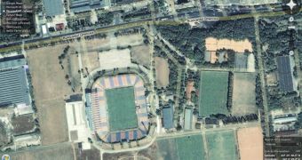
Nowadays, there are numerous software solutions that are able to provide satellite imagery for free, allowing the users to view any corner of the world straight from their web-browser. But there are users who would want to use a certain application because the other technologies available on the market are not as powerful as it or because it doesn't contain some features. That's why it would be great to have an all-in-one technology that provides one click access to most of the mapping tools created by the software companies. At this time, we can talk about Google Maps, Virtual Earth, Yahoo Maps and the Ask.com mapping solution, most of them providing the same features.
Well, that's why Flash Earth was created. It includes all the above technologies plus OpenLayers and NASA Terra. The only difference is that it is entirely based on Flash, providing better functionality for all the mapping tools. Obviously, you'll have to install Flash in order to use it with all its functions. I tested Flash Earth on Opera, Safari and Firefox, all of them on Mac OS X and it works fine without any bug or issue.
Personally, I found this project quite amazing because it includes all the popular mapping technologies available out there so there is no need to load a different page for every product. But besides all this, Flash Earth offers almost the same functionality as the main stand-alone solution. Let's make a comparison between it and Google Maps. Flash Earth has the entire collection of imagery provided by Google maps and it also offers zoom abilities as well as drag and drop support.
As you expected, the service is available for free and can be accessed without the need of installing a software. If you want to try it now, you can click on this link to visit the main page of Flash Earth.

 14 DAY TRIAL //