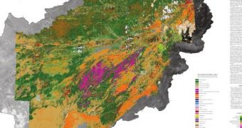
Officials from the US Geological Survey (USGS) and the Department of Defense's (DOD) Task Force for Business and Stability Operation participated in a ceremony at the Afghan Embassy in Washington yesterday, July 17. At the meeting, they presented Afghan authorities with a map of their country.
But this was no ordinary map, but the first broad hyperspectral map ever created of a sovereign nation. According to US scientists, the advanced remote sensing technique was used to image around 70 percent of the Asian country's total surface area.
Afghan authorities will now have an easier time identifying, cataloging and exploiting their abundant natural resources, something that has thus far been made difficult by the lack of access to new maps and orbital images.
Though this may be a gesture of friendship, I find it sad that the main reason why the USGS and TFBSO helped the Afghan government out is for the mineral deposits the map revealed to be opened for business, as in given into the custody of multinational mining corporations.

 14 DAY TRIAL //