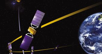
During a meeting held yesterday, June 22, at the 2011 Paris Air and Space Show, representatives from the European Space Agency (ESA) signed the final contracts covering the satellite control and related systems needed for the good operations of the ESA Galileo satellite navigation network.
The first two spacecraft of the constellation are scheduled to be launched on October 20, from the Kourou Spaceport, in French Guiana, South America. This will mark a momentous milestone in the European effort to create its own satellite navigation system.
In order for Galileo to be functional, a worldwide ground network needs to be put into place as soon as possible. Its purpose will be to receive, centralize, analyze, and then disperse data sent from dozens of satellite in Earth's orbit.
In order for the satnav system to be brought online, ESA needed to have all its six Work Packages approved and deployed. Four of them were already green-lighted, and yesterday's conference ensured that the remaining two were brought into play as well.
What this means is that the network now has all of its necessary components, funds, systems and so on to begin operations. All that is needed for them to commence is the actual satellite launch. The first Galileo spacecraft will be launched to space by Russian-built Soyuz rockets.
For the assembly stage of Galileo, ESA built a new launch pad at Kourou, under a cooperative agreement with the Russian Federal Space Agency (RosCosmos). Over the past few years, Russian engineers have lived in South America, assembling the new facility.
“The control segment already deployed for the first four satellites consists of a Galileo Control Center in Oberpfaffenhofen, Germany and two Telemetry, Tracking and Command facilities in Kourou, French Guiana and Kiruna, Sweden,” experts at the agency explain.
“The current mission segment for the first four satellites consists of a control center in Fucino, eight sensor stations around the world on European territory and five similarly distributed uplink stations,” an ESA press release reads.
“For the first operational phase, the mission segment will also be added to the Oberfaffenhofen control center – so the two control centers will be redundant– as well as eight more uplink stations,” the document adds.
Europe is building its own navigation system because the United States do not provide their allies with relevant, precise Global Positioning System (GPS) data. Those information are reserved exclusively for military use.

 14 DAY TRIAL //