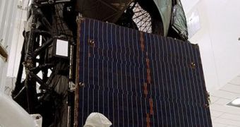
Yesterday, April 12, the American and Japanese space agencies (NASA and JAXA) signed a new collaboration agreement, which seeks to augment their joint abilities of performing a particular type of Earth observations. The two nations will pull their satellite resources together in this area, a feat that will help them obtain results twice as often, with a higher degree of accuracy, and also in more depth than possible until now. Earthquake hazards, forest declines, and changing water resources are the main objectives of the cooperation, officials at NASA say in a press release on their official website.
The partnership is targeted at using the American space agency's Tracking and Data Relay Satellite System (TDRSS) as a relay for downloading observations data collected by the JAXA Advanced Land Observing Satellite (ALOS). The Japanese spacecraft will therefore become able to conduct scientific surveys a lot often, essentially doubling the amount of data return it is currently capable of.
“This is a great example of the value to be gained through international collaboration between the world's Earth-observing nations. By working together and sharing satellite resources like this, we can produce more data more rapidly and cost-effectively than if each of us went it alone,” says NASA Headquarters Science Mission Directorate Earth Science Division director, Michael Freilich.
The reason why the Untied States got involved in this partnership is the fact that the ALOS spacecraft features the PALSAR instrument. The Phased Array type L-band synthetic aperture radar is a scientific equipment capable of measuring its distance to the surface of the planet at all times, regardless of the weather down below. While this may not seem like much, the radar can be used to perform studies of how the ground is displaced during landslides, earthquakes, and volcanic eruptions. The spread of forests, and the impact of deforestation in certain areas, can also be mapped with high precision.
At this point, NASA does not have a radar similar to the PALSAR in Earth's orbit. A mission featuring such a device is in the works and is due to launch later in the decade. At this point, scientists in the US rely on data provided by foreign satellites, such as ALOS. Thanks to the new agreement, it will become a lot easier for them to access the datasets, helping them respond to emergencies faster than ever before. In addition to this line of study, the ALOS information will also be used to determine the speed at which ice sheets and glaciers move.
The data the Japanese spacecraft will collect over North America will only be used for peaceful, scientific purposes, according to the document. The NASA Alaska Satellite Facility data center will be used for distributing the ALOS data to scientists affiliated with government agencies in the US. “The expanded ALOS data flow will significantly improve our scientists' ability to monitor regions at risk to earthquake hazards, such as Haiti and Chile,” explains NASA Earth Science Division natural hazards program manager Craig Dobson.
“Now we will be able to see very small changes in surface elevation associated with the build-up and release of strain in seismic zones over virtually the entire area of the Americas, with measurements made as often as every 46 days. Scientists also will be able to monitor seasonal changes in groundwater resources,” he adds. The TDRSS system features 8 communications satellites, all of them in geosynchronous orbits.

 14 DAY TRIAL //