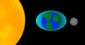
Everyone knows that the world's oceans and seas are subjected to tidal forces, which make them go up and down two times per day. But what's a little less known is the fact that the ground also follows a similar pattern, moving under the influence of the Sun and the Moon. Its variation can measure as much as 20 to 30 centimeters every day. Basically, it moves up when the Sun's attraction is strongest, and then lowers itself back down. This process happens on a very wide surface at very low speeds, and is therefore unnoticeable to human beings, as is the fact that the Earth is rotating.
Now, seismology experts are analyzing these little-known movements, in an attempt to detect potential “hot spots” for future earthquakes, and also to understand how magma dynamics affect the way our planet complies with gravitational pulls from the celestial objects around us. They say that it's possible the lava flow beneath the terrestrial crust is also influenced by the Sun and the Moon, and that this new insight may offer valuable information as to the forces that interact deep within our planet, next to its central core.
Geologists Miaki Ishii, an assistant professor of earth and planetary sciences, and Jim Davis, from the Harvard-Smithsonian Center for Astrophysics, are currently engaged in large-scale research, trying to determine the exact composition of the molten lava beneath the surface, and to understand exactly how the convection forces move it around. They suggest that a never-ending cycle exists, in which large chunks of rocks, perhaps as large as continents, constantly move towards the upper crust, and then back downwards, in a process that most likely takes millions of years to happen once.
Talking about the current lack of tsunami and earthquake warning systems, Ishii said that “Seismic waves propagate like they would if you threw a pebble in a pond. You get ripples propagating away from the stone. If you look at it, you know almost immediately where the stone was thrown. With seismic waves, we back-project the curvature of the ripples to see where the ripples started. If you can get the data in real time, this is a quick and easy method to get the magnitude.” The last great tsunami, the one that struck in South Asia, was not preceded by a proper warning, and therefore the 9.2 magnitude tremor caused numerous victims.
“There are lots of things going down and also coming up through volcanoes, so there’s lots of information. The goal is to come up with a better view of a subduction zone from a seismic point of view. It is actually an Earth factory. If you have a better catalog, you can understand earthquakes better and understand what sorts of quakes to expect in the future,” the geologist concluded.

 14 DAY TRIAL //