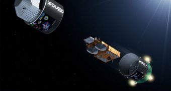
Starting this fall, the European Space Agency (ESA) will increase its abilities of keeping an eye on the planet's polar caps. This will become possible once the check-out period on the Cryosat-2 is completed. The satellite, which is one of the most sensitive ever launched, took off aboard a Dnepr rocket yesterday, from the Baikonur Cosmodrome, in Kazakhstan. The Russian-Ukrainian delivery system that carried the satellite roared into space at 15:57 CEST (13:57 UTC), inserting the Cryosat-2 into a 447-mile (720-kilometer) near-polar orbit, with a 92-degree inclination, Space reports.
“We know from our radar satellites that sea ice extent is diminishing, but there is still an urgent need to understand how the volume of ice is changing. To make these calculations, scientists also need information on ice thickness, which is exactly what our new CryoSat satellite will provide. We are now very much looking forward to receiving the first data from the mission,” said after the launch the ESA Director of Earth Observation Program, Volker Liebig. The successful separation of Cryosat-2 from the second stage of the converted SS-18 ICBM was confirmed yesterday by an ESA ground tracking station based in Malindi, Kenya.
The satellite was supposed to launch some time ago, but concerns over the safety of the Dnepr vehicle prompted some delays. Once technical difficulties related to the delivery system were resolved, the 1,587-pound (720-kilogram) satellite was mated with its fairing. Because the spacecraft is no less than 4.6 meters in length, Russian engineers had to modify the second stage of the rocket, and make it bigger. They also changed the fuel mix that fed Dnepr's second stage engines, so as to allow the ICBM to achieve the 720-kilometer altitude. On account of these modifications, the cover of the launch silo from which the mission took off was left open in the days leading to the launch.
The main mission Cryosat-2 has is to measure with extreme accuracy the evolution of Earth's polar caps. These measurements are of vital importance for informing policymakers in their initiatives to mitigate global warming and climate change. The spacecraft is capable of taking centimeter-resolution readings of the ices, showing when and where it is melting, and where it's growing. Officials at ESA say that, once the commissioning and testing phases are done, in about six months, the satellite will enter its observations stage, which will last for about three years.

 14 DAY TRIAL //