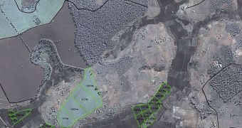
Spacecraft operated by the European Space Agency (ESA) are now heavily involved in helping people living in poor, underdeveloped areas of the world boost their agricultural production rates. This is done by indicating the most suitable way of dividing up the land from up above.
ESA is working together with the International Fund for Agricultural Development (IFAD) on this project. This is an organization whose role is to fund projects for poor areas, and to aid people here make the best of the land they have at their disposal.
As such, IFAD operates a number of development projects in parallel. However, the agency lacks the resources necessary to assess the impacts of each of its policies correctly. This is where ESA steps in.
The latter uses its orbital observatories to carry out investigations on the ground, collecting data that ultimately lead to an increased ability to design, plan and monitor the impact that policies promoted by the IFAD have.
The two organizations first collaborated in the case of Madagascar, a country that is experiencing a massive population boom, but where resources are scarce and a food crisis imminent. In this region alone, ESA carried out three validation, trial tests, meant to assess how effective its satellites are.
“Since remote sensing has become a popular area of study and experts can be found all around the world, incorporating these data into our projects helps us to strengthen local capacity and transfer knowledge to local stakeholders to improve national capacities,” explains Benoit Thierry.
The official is the IFAD Madagascar Country Program Manager, and is one of the key actors in the collaboration. He explains that the space agency managed to provide his organization with maps that showed how land use changed in the entire country over the past 15 years.
“With these products, we can get details about the land and develop action plans much quicker by sending teams only to select areas,” Thierry says of the maps. He adds that even the location of specific fields can be made out on the new images.
“If we don’t incorporate this technology into our work now, I’m afraid we will miss the train,” the IFAD official concludes.

 14 DAY TRIAL //