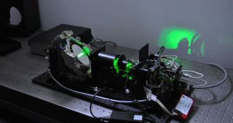
Experts with the European Space Agency (ESA) are currently working on developing a LIDAR (light detection and ranging) sensors for deep space exploration. This device could come in handy for long duration missions, but it could also make it easier to conduct complex scientific experiments.
Basically, a LIDAR is the laser-based equivalent of a radar. The difference is that it can scan objects in 3D, providing data on altitude, for example. The technology is already used here on Earth, for conducting altimetry experiments from aboard airplanes.
According to ESA, the technology is being developed as a “navigation aid for exploring deep space.” LIDAR works by sending out pulses of laser light, and then analyzing the patterns in which the photons are reflected back.
Radar works in pretty much the same way, except it sends out radio pulses, and analyzes the very tiny portion of the original signal that returns to the source. Light detection and ranging relies on analyzing the time it takes for emitted light pulses to return.
The reason why LIDAR gives much more precise measurements is that its visible light has a much shorter wavelength (billionths of a meter) than radio waves (centimeters) do. At this point, this tool is used in space as well, primarily on spacecraft attempting to dock to the International Space Station.
The entire system is accurate within a couple of centimeters. This level of precision is truly remarkable, considering the complexity of operations involved in docking two spacecraft. ESA uses LIDAR on its Automated Transfer Vehicles (ATV), which resupply the ISS.
In the future, the agency hopes to use this tool to create complex maps of surfaces before landing spacecraft. This could be very useful for missions aimed at Mars, the Moon or the moons of gas giants like Jupiter and Saturn.
LIDAR would allow spacecraft to conduct accurate surface surveys, producing high-resolution images that will enable Mission Control to select the best, safest landing spot. The advantage to using this approach is that it doesn't matter if the target object is in total darkness or bathed in sunlight.
“The 3D imaging LIDAR we’ve been working on has three main potential applications. The first is for the guidance, navigation and control of planetary landers, in particular in selecting a safe landing site,” says ESA LIDAR project coordinator, Joao Pereira Do Carmo.
“The second is for steering rovers on planetary surfaces, and the third is for docking in planetary orbit. The challenge is to produce a new class of imaging lidar, much smaller and needing less power,” he adds.
“It is expected that we can reduce the mass and power consumptions of current commercial imaging LIDAR systems by at least 70” percent, Joao Pereira Do Carmo concludes.

 14 DAY TRIAL //