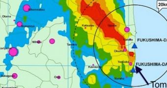
On March 11, 2011, a magnitude 9.0 earthquake struck off the coasts of Japan, producing a large tsunami that severely affected reactors at the Fukushima Daiichi Nuclear Power Plant, leading to one of the worst nuclear accidents in history. A company called Drone Adventures last year used Unmanned Aerial Vehicles (UAV) to map how the area is recovering from this disaster.
The radioactive emissions continue from the damaged reactors to this day, despite measures taken by the Tokyo Electric Power Company (TEPCO) to mitigate the leaks. The entire area around the power plant is now closed off on a 20-kilometer (12.5-mile) radius and inaccessible without clearance.
Back in November 2013, Drone Adventures used its UAV to study three cities around the Fukushima site, including Hisanohama, Iidate, and Tomioka. The company has extensive experience with post-disaster autonomous drone mapping missions, having already conducted such studies following the magnitude 7.0 earthquake that struck Haiti in 2010, killing 100,000 to 160,000 people.
Such mapping studies are useful because they aid relief supply distribution efforts in the short term, while also contributing to planning infrastructure repair and management in the long run. Last year, Drone Adventures collaborated with the Center for Spatial Information Science at the University of Tokyo to conduct a similar assessment of Fukushima, tracking disaster recovery efforts in the area.
“We set up around the local school, which was abandoned suddenly during the disaster and hasn’t been returned to since. Classrooms are still full of books, desks, and chairs. The school greenhouses are now full of weeds, and the plastic pots have most likely been knocked over by wild boars,” the company says in a statement.
“We launched two flights of our drones from the school’s baseball field and a third one from a local rice field, and were able to map the entire village, surrounding fields, and local forest. Piles of contaminated soil are clearly visible from above,” the press release goes on to say.
According to the new study, the city of Tomioka displays most of the characteristics associated with a nuclear wasteland. Located just 10 kilometers (around 6 miles) south of Fukushima, the town was severely affected by the earthquake, the tsunami the latter caused, and the nuclear emissions from the nearby power plant. Many buildings have collapsed and numerous cars are upturned in the streets.
“We set up in the parking lot of Tomioka train station, whose tracks are overgrown with weeds and blocked by a few cars. We launched another two flights to map the village, staying just outside the airspace of the power plants both north and south of the town. Given the scale of the damage and contamination, Tomioka may never return to being the town it once was,” the company says.

 14 DAY TRIAL //