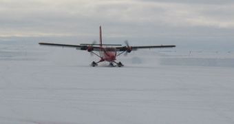
Experts with the CryoSat science data validation team have recently begun a new set of investigations in the Arctic. The goal of this campaign is to check that the advanced orbital observatory is functioning properly, and that tis data are reliable.
Every new Earth-monitoring satellite that features innovative technologies needs to be cross-checked with readings collected from the field, and the European Space Agency's (ESA) CryoSat is no exception to this rule.
Launched in orbit in 2010, the satellite is part of a broader cooperation agreement between ESA and the American space agency. Its main goal is to keep an eye on Earth's ice masses, especially those in the Arctic, Antarctica and in Greenland.
But the observatory also features a host of new technologies, including a radar altimeter that is the first of its kind ever to fly in space. The measurements it produces therefore have no frame of reference to which they can be compared.
This is what elicited the need to conduct an actual expedition in the lands which CryoSat surveys from hundreds of miles above. Researchers are focusing their attention on ice thickness, as this is the most important parameter the ESA mission needs to monitor.
The broader goal of its investigation is to provide researchers with a crystal clear understanding of the correlations that bind Earth's ices to phenomena such as global warming and climate change.
“This is one of the most important validation campaigns for CryoSat, as for the first time, we are going to measure ice simultaneously from space, from the air and on the ground,” explains the ESA CryoSat mission manager, Tommaso Parrinello.
Research teams are currently being deployed in central Greenland, Svalbard, the Fram Strait, Devon Island and in northern Canada. The effort is scheduled to last for about a month, the official adds.
“We are excited by the collaboration with NASA,” says the CryoSat validation manager at ESA, Malcolm Davidson. The American space agency is taking part in this endeavor by providing data collected during its own Operation IceBridge, currently underway in the Arctic.
“By cooperating in collecting a huge and varied airborne dataset, probing different types of snow and ice with a range of instruments, we get a better understanding of the data from the CryoSat and ICESat missions,” Davidson explains.
“This is a great opportunity to explore the possibilities of mapping ice-thickness change in the Arctic using both ESA and NASA missions,” he concludes.

 14 DAY TRIAL //