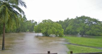
Investigators from the University of Houston are currently working on developing a new technology, that will allow for the creation of flood mapping systems that function in real time.
The system is designed to address flash floods, which are produced after intense thunderstorms and heavy rains, and which are nothing but nuisances to most people.
But they could also mean the difference between life and death for people trusting their faiths in Emergency Medical Services (EMS) crews.
If the emergency personnel arrives just minutes later than they are supposed to, then there is a high chance that the person from whom the ambulance was called is already dead.
As such, knowing which areas experience floods at any given time could help EMS workers save numerous lives in areas prone to flash floods.
In charge of the team developing the new system is UH professor Gino Lim, who was recently awarded $400,700 by the city of Houston.
He got the money in order to build a computer program that would offer a real-time view of the level of flooding on roads near major highways within the Sam Houston Parkway (State Highway Beltway 8).
The new system will be similar to the existing TranStar's online real-time traffic map. The only difference is that the flood warning system will be color-coded, depending on the severity of the floods.
“This will be a major advancement. In Harris County, street flooding and the resulting traffic problems are still unresolved problems,” explains Lim.
The expert also holds appointments as the Hari and Anjali Agrawal Faculty Fellow, and as an associate professor of industrial engineering at the university.
“But the inability to effectively inform and navigate emergency vehicles through flooded streets is not caused by a lack of technology but by the lack of proper integration of available technologies,” he adds.
“This tool will substantially improve first responders' decision-making abilities and their response times. Information like this is priceless and could mean the difference between life and death,” Lim explains further.
Experts expect the new system to be in place by the time the hurricane season starts in June 2013. At this point, Lim says that, most likely, the signals that will underlie the real-time map will be sent via TV signals.
“During Hurricane Ike two years ago, we did a lot of testing on data transfer,” he says.
“What we found is there can be problems with wireless connections because they are reaching the maximum capacity of some towers, which makes this communication difficult,” Lim concludes.

 14 DAY TRIAL //