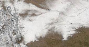
On February 5, the NASA Aqua satellite trained its Moderate Resolution Imaging Spectroradiometer (MODIS) instrument on a portion of the United States covering Colorado and Nebraska, which were severely affected by an impressive snowstorm just days earlier.
As clearly visible from this image, the weather front brought on record-setting snowfall in Colorado for the month of February, leading to significant economic losses due to a closer interstate. Flights were also canceled throughout the state, while much of the Denver area was buried under a foot (30 centimeters) of snow.
Nebraska was next in line, as MODIS data clearly indicate. Usually, the states are blasted with such weather around March or April, but somehow the events veered off-scheduled. Many climate scientists say that global warming is to blame for the shift in precipitation patterns.

 14 DAY TRIAL //