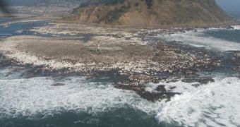
The magnitude 8.8 earthquake that struck Chile on February 27 this year had far-reaching effects that are only now beginning to show their full extent. Immediately after the natural disaster struck, experts discovered that it had shifted Earth's axis, causing the days to shorten by 1.26 microseconds. It was later found that some cities had been moved up to 10 feet (roughly 3 meters) away from their initial positions, with the change affecting cities as far off as Argentina. But a new study shows that the tremor also caused the Chilean shoreline to shift.
According to OurAmazingPlanet, it would appear that the lands located near the country's coastlines were raised about 8 feet, or about 2.5 meters, above their usual levels. At the same time, land situated further inland dropped in height by about the same amount. Experts say that it's not uncommon for this type of effects to take place, given that the country itself is located on the Pacific Ring of Fire. This is a major feature that includes the western coasts of the America, and the eastern coasts of Japan and Australia, and which is characterized by massive volcanic activity and the risk of major earthquakes.
The reason this happens is because the Pacific tectonic plate is being squeezed by the North and South American plates, as well as by the Eurasian and Australian plates. This causes the plates to rise on top of each other, a process called subduction. Whenever a blockage appears in the smooth flow of one plate under the other, the process is halted. Energy accumulates in the gigantic plates, until finally the obstacle is broken, and the process resumes violently. This is when earthquakes happen. The tectonic plates themselves float on a layer of molten rock that envelops Earth's core, called the mantle.
Seismologists at the US Geological Survey (USGS) report that this year's tremor managed to rupture a major fault line alongside the Chilean coast, which is the main reason why the land was lifted by so much. “You can just see the sea shells and sea weed hanging in the air, about head high. You see all this stuff that belongs underwater is now up in the rocks,” explains Ohio State University (OSU) geophysicist Michael Bevis. “We've instrumented the crap out of the fifth biggest quake ever. When we put this data together we're going to figure out what happened during and after the earthquake with an impressive level of detail,” he concludes.

 14 DAY TRIAL //