14 DAY TRIAL //
 California's massive wildfire, which is growing bigger everyday while authorities struggle to contain it, has been imaged from space by NASA. The image was taken last week, since then the fire has spread further.
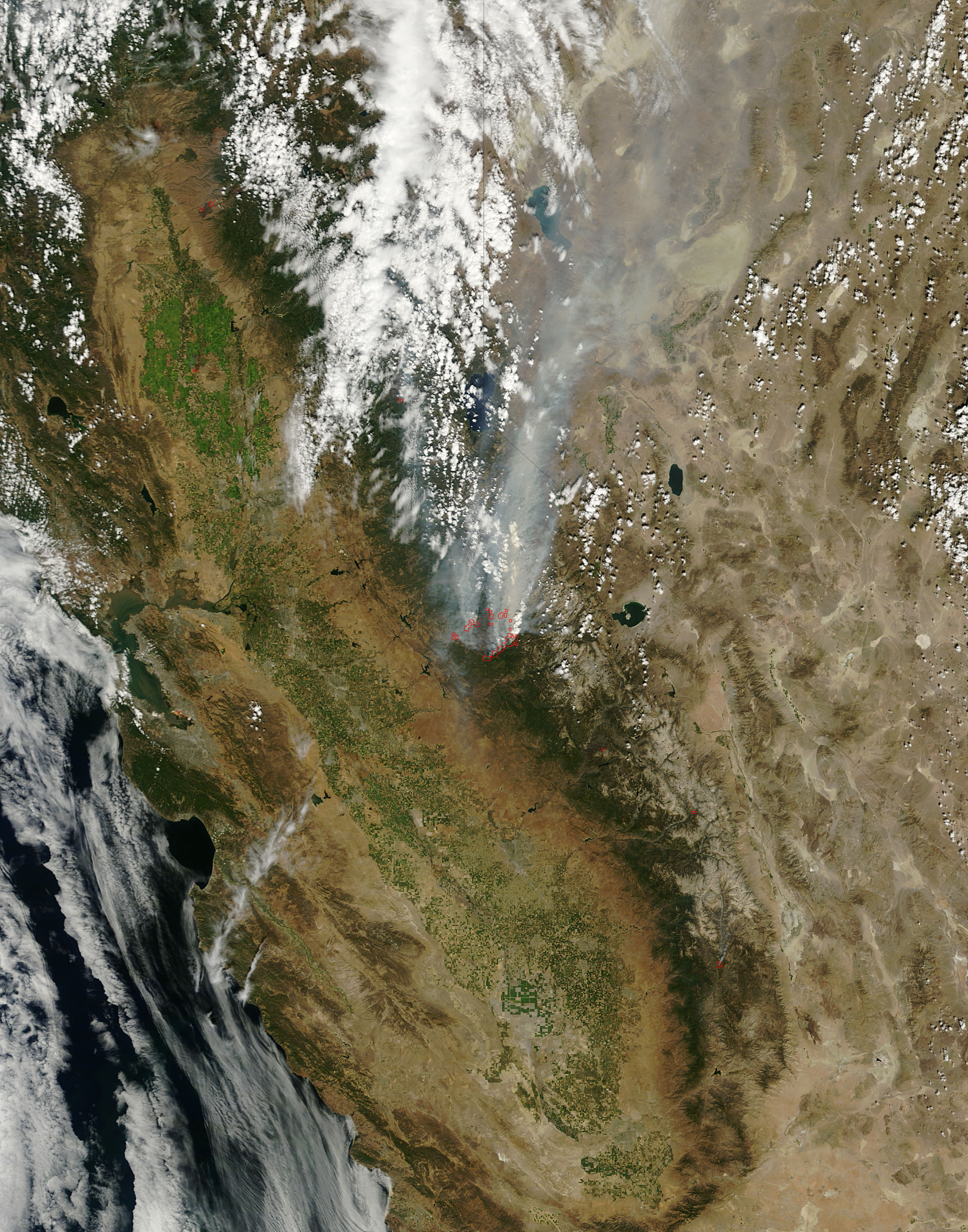
Even so, the satellite image provides a very clear view of the extent of the fire, which has been called the Rim Fire.
"On August 22, 2013, the Moderate Resolution Imaging Spectroradiometer (MODIS) on NASA’s Aqua satellite acquired this image of the drought-fueled Rim fire burning in central California, near Yosemite National Park," NASA explained.
"Red outlines indicate hot spots where MODIS detected unusually warm surface temperatures associated with fires. Winds blew a thick smoke plume toward the northeast. A smaller fire—American fire—burned to the north," it added.
The fire has since gotten nearer to San Francisco's water supply. While the supply is not in danger yet, firefighters are trying to at least contain the fire so it doesn't affect the water or electrical supplies of the major city. Update: NASA has now published an updated image of the fire shot yesterday August 25.