Microsoft has introduced a massive imagery update for its mapping, search and location platform at the start of 2010. So massive, in fact, that the Redmond company has had to break the refresh into half and make the content available via two different updates. In total, the new imagery release delivered to Bing Maps in January 2010 covers in excess of 1 million kilometers, according to Chris Pendleton, the Bing Maps technical evangelist for Microsoft. The first Bing Maps imagery refresh was introduced in mid-January, with the software giant promising that more was to come.
“The January 2010 Part 1 release is 558,000 square kilometers of imagery consisting of: Germany’s Ruhrgebeit, Belgium, Luxembourg, Vancouver – Sea to Sky Hwy to Squamish and beyond, additional imagery scattered throughout Russia, Bulgaria, Hungary, Poland, Latvia and Turkey,” Pendleton noted.
The first release of new content for Bing Maps was the largest of the two offered by Microsoft. The second part of the update was published at the start of February, and covered no less than 446,000 square kilometers of new Ortho imagery. Combined, the two updates introduced to Bing Maps cover in excess of 1 million sq. km. of new imagery. Pendleton underlined that the refreshes represented the evolution of Bing Maps just for a single month.
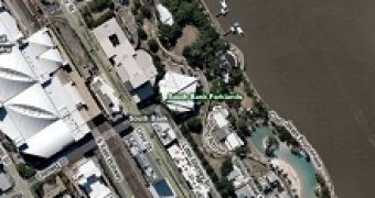
The second half of the January 2010 update to Bing Maps features imagery of: “Brisbane (Australia) and Brisbane International Airport Area (Australia) , Gold Coast (Australia), Murarrie-Raby Bay (Australia), Auckland (New Zealand), United Kingdom (21,000+ sq km), Santa Barbara, CA (USA), Crested Butte, CO (USA), Copper Mountain, CO (USA), Erie, PA (USA), Pittsburgh, PA (USA). Additional areas of interest around the world including Switzerland, Australia, New Zealand, Mexico, South Africa, Swaziland, Morocco, Namibia, Botswana, Czech Republic, Estonia, Lithuania, Slovakia, Russia, Bulgaria, Hungary, Poland, Latvia, Turkey and Romania,” Pendleton stated.

 14 DAY TRIAL //