The last day in March 2010 brought with it new updates to Microsoft’s mapping, search and location platform. In this regard, the Redmond company introduced in excess of 6.2 million square kilometers of new imagery that it divided into a couple of releases. At the same time, the software giant kicked up a notch a Bing Maps adjacent application designed to simplify the discoverability of new content added monthly to the platform.
According to Chris Pendleton, the Bing Maps technical evangelist for Microsoft, the first part of the March 2010 imagery update delivered no less than 4.9 million square kilometers of both “new and refreshed imagery! The update includes high resolution 20cm aerial for USA and 60cm satellite updates for Australia, Botswana, Bulgaria, Lesotho, Mexico, Morocco, Namibia, New Zealand, Romania, Russian Federation, Slovakia, South Africa and Turkey.”
The second part of the update involved just 1.3 million square kilometers of imagery, including new and refreshed content. This time around, the high-resolution 20cm aerial imagery included coverage of the “USA, Mexico, Australia, Austria, France, Italy, Japan, Portugal, Slovakia and the UK and 60cm satellite updates for Australia, Chile, Lesotho, Mexico, Namibia, New Zealand, Russian Federation, Slovenia and South Africa,” Pendleton explained.
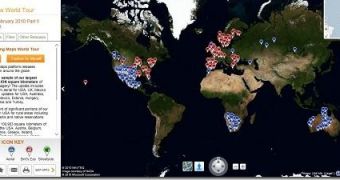
The Bing Maps World Tour application also evolved, as Microsoft worked to take the application set up to allow users to navigate new imagery added to Bing Maps via a release-by-release breakdown. Via the application, users can go as far back as August 2009 and check out the evolution of Bing Maps in terms of new content month after month. Pendleton revealed that the new Would Tour app was brought into Bing Maps from Windows Azure, and fitted with a new user interface in an effort to consolidate the experience for end users.
Users will be able to start exploring new Bing Maps content via the 4 World Tour app tabs Welcome, Highlights, Filter and Other Releases. Of course, they can just use the controls made available and let the slideshow of any imagery release play.
“The Highlights tab is a quick view at some of the notable places where imagery was released for the respective release. Here you can see a list of places, with the respective countries, imagery type and total square kilometers for the respective location for that release. The Filter tab allows you to view all of the imagery for the selected release by either continent or type. So, if you only want to see the new Aerial imagery for Oceania in the February 2010 Part 2 release, you just select ‘Oceania’ then select ‘Aerial’ after setting the release date in the ‘Other Release’ tab. The Other Releases tab gives you access to previous releases. So, if you want to see the imagery updates for August 2009 click the Other Releases tab and select August, 2009,” Pendleton said.

 14 DAY TRIAL //