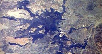
Last year, a corner of Saudi Arabia was subjected to a series of small earthquakes, which finally revealed to scientists the area is more volcanically active than they had estimated.
Back in 2009, a part of the country that is located nearest to Egypt experienced as much as 30,000 small tremors, hinting at the fact that something big is going on underground.
According to investigators in a new study, who got a chance to look over the tremor data, it could be that this study will be able to help researchers in developing better prediction methods as to when volcanoes might erupt.
All the 30,000 small earthquakes that were recorded scientifically struck the Harrat Lunayyir lava field, which is located in the geologically-peaceful northwestern regions of Saudi Arabia.
At least this is what geologists thought until last year. There was only a small number of eruptions, earthquakes, or other manifestations of seismic activity here in the past millennium, experts say.
The swarm of tremors struck the area between April and June, and reached peak intensity on May 19. Several earthquakes with magnitude 4.0 or greater occurred, and even one of magnitude 5.4.
The government issued an evacuation notice, and 40,000 residents were taken out of their homes. They were caught off-guard though, given that no one expected tremors to strike here.
Geological maps show that Harrat Lunayyir, a lava field that began forming no less than 30 million years ago, is located some 200 kilometers (120 miles) away from the Red Sea.
This is the place where new crust is being formed, at the Red Sea Rift. The formation separates the African Plate and the Arabian Plate, which push away from each other.
But “the Red Sea rift is a very active place to start with, with a chain of volcanoes down the middle of it that we're rarely aware of because they are underwater,” explains John Pallister.
The researcher holds an appointment as a volcanologist at the US Geological Survey (USGS). He is also the volcano disaster assistance program chief at the federal agency.
“When continents are being pulled apart as you have there, you'll often see intrusions of magma on the shoulders of the rift,” he adds.
This basically means that magma from the Earth's mantle has infiltrated very deep “inland,” until it reached the lava field.
“It is more likely that we'll get additional intrusions of magma and potentially even an eruption in this area – the pathway is prepared,” Pallister explains for Our Amazing Planet.
Details of the new work were published in the September 26 issue of the esteemed scientific journal Nature Geoscience.

 14 DAY TRIAL //