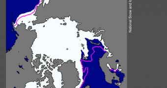
A new report released by the US National Snow and Ice Data Center (NSIDC) shows that ices surrounding the North Pole exhibited an abnormal evolution pattern throughout January 2012.
For starters, the team determined that the Pacific side of the Arctic exhibited strong ice growth and development. On the other hand, the Atlantic side displayed lower-than-normal freeze-over rates.
Unfortunately, overall values indicate that the total amount of ice produced during winter was still lower than normal, despite the growth on the Pacific side. Primarily, ice was broken apart by winds.
Weird wind patterns dispersed the forming ices as they were still very sensitive to external influences. These correlations maintained even after scientists accounted for usual variations in ice thickness.
Climatologists know that newly-formed ice in the Arctic display very broad variations in terms of the areas it covers. The North Pole experiences yearly maximum ice coverage in late February or March.
For the month of February, the NSIDC established the about 14.56 million square kilometers (5.62 million square miles) of the Arctic were covered in ice. That value is about 1.06 million square kilometers (409,000 square miles) less than the long-term average calculated for 1979 and 2000.
“Continuing the pattern established in January, conditions differed greatly between the Atlantic and Pacific sides of the Arctic. On the Atlantic side, especially in the Barents Sea, air temperatures were higher than average and ice extent was unusually low,” the report indicates.
“February ice extent for the Barents Sea was the lowest in the satellite record. Air temperatures over the Laptev, Kara and Barents seas ranged from 4 to 8 degrees Celsius (7 to 14 degrees Fahrenheit) above average at the 925 hectopascal (hPa ) level (about 3000 feet above sea level),” the team says.
At the same time, the Pacific side of the Arctic exhibited the second-highest ice extent on the satellite record. Temperatures were between 3 to 5 degrees Celsius (5 to 9 degrees Fahrenheit) below normal.
“Arctic sea ice extent for February 2012 was the fifth lowest in the satellite record. Including the year 2012, the linear rate of decline for February ice extent over the satellite record is 3.0% per decade,” the new report states.
What this means is that, in spite of regional improvements, the overall trend is still for the Arctic to lose more and more ice every single year. This is in tune with models developed by climate experts.

 14 DAY TRIAL //