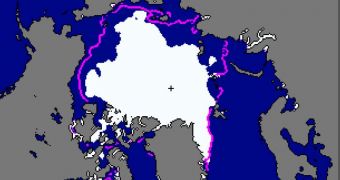
Researchers with the US National Snow and Ice Data Center (NSIDC) say that their latest measurements of sea ice extents in the Arctic indicate values approaching the all-time record low registered back in 2007.
The team explains that the ice extent for the month of August was the second-lowest ever recorded since satellite observations of the region began in 1979. This is when climate scientists began keeping track of how ices shift over years and decades.
According to the experts, both the Northwest Passage and the Northern Sea routes remained opened throughout last month, which is uncommon for this time of year. These discoveries again underline the fact that the Arctic is threatened by shifting climate conditions.
Global warming and a number of other factors are causing the ice shelfs surrounding the North Pole to lose a lot of their multi-year ice. During the following winter, only a small portion of that permanent ice is replaced, and the cycle begins anew the following season.
NSIDC officials expect to have the final values of how much sea ice declined this year in the first few days of October. They say that the minimum ice extent for 2011 will be reached sometime in the next couple of weeks. Once the ices start growing again, they will issue a statement announcing it.
“Average ice extent for August 2011 was 5.52 million square kilometers (2.13 million square miles),” an official press release from the research group announced. Climate scientists say that ice extents could very well set a new all-time record low, dropping below 2007 values.
“This is 160,000 square kilometers (61,800 square miles) above the previous record low for the month, set in August 2007, and 2.15 million square kilometers (830,000 square miles), or 28 [percent] below the average for 1979 to 2000,” the team adds.
At the end of last month, on the 31st, sea ice extent was 4.63 million square kilometers (1.79 million square miles), which is only 100,000 square kilometers (38,600 square miles) above the values recoded on August 31, 2007.
A team of scientists at the University of Bremen, in Germany, used high-resolution Advanced Microwave Scanning Radiometer-Earth Observing System (AMSR-E) data for creating a new model of the situation.
They found that ice extents for September 5, 2011, could drop below values recorded 4 years ago, in effect making this month the warmest on satellite record for the Arctic. Next month's NSIDC report will contain the necessary data, so keep an eye on this space for more details.

 14 DAY TRIAL //