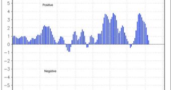
Large portions of the United States and Eastern Europe are currently experiencing warmer-than-normal conditions, with reduced snowfall. Scientists say that this is due to the fact that the Arctic Oscillation is currently positive, as opposed to the last two years, when its values were negative.
The AO is an index that is in part determined by how much Arctic air makes its way to mid-latitudes on our planet. It can influence locations thousands of miles away, and also has a component dictated by variations in sea-level pressure at medium or high latitudes.
A negative AO has been associated with a colder, wetter winter for the Northern Hemisphere. Such a negative phase occurred over the past two winters, which have been especially rough. The fact that the AO is currently in a positive phase explains the lack of snow and cold temperatures in Europe and the US.
“Some scientists have speculated that the negative Arctic Oscillation pattern of the last two winters was in part driven by low sea ice extent. The recurrence of the positive phase of the Arctic Oscillation so far this winter, following a near-record low summer sea ice extent, does not support this thinking,” says experts from the US National Snow and Ice Data Center.

 14 DAY TRIAL //